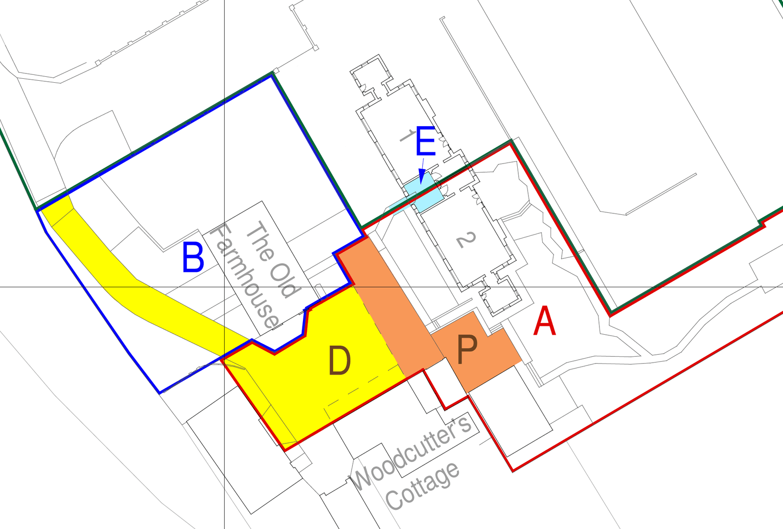
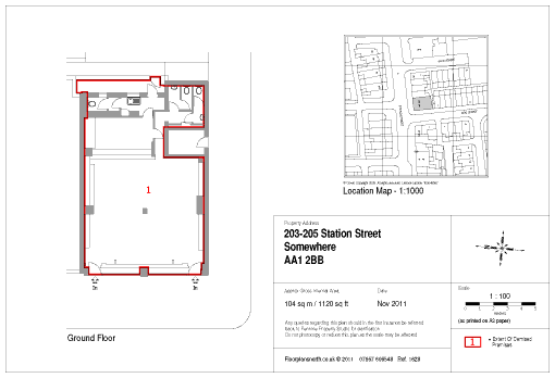
I am a Land / Measured Building / Boundary surveyor specialising in producing Lease Plans and Title Deed plans compliant with the requirements of HM Land Registry.
I have over 20 years of experience and cover the whole UK, but particularly London, Leeds, Manchester and the areas between.
I use cutting edge technology to allow efficient use of time on site and ensure my plans are accurate.
My fees start from £540 for a typical house split into 2 flats.
Lease plans are tailored for the site, but usually show detailed internal plans for each floor occupied by the demise, plus the location mapping based on detailed OS mapping. With scale bars and north indications I ensure these plans meet Land Registry specifications.
Title plans show my site mapping superimposed upon the detailed OS mapping for the surrounding area. For most sites I use a survey grade GPS system to ensure boundaries features and other details are located accurately.
Boundary disputes: as an expert witness, I provide site plans and impartial boundary reports appraising historic documentation and physical site evidence, and evaluating claims of each party against evidence. I only take on this work for clients who engage a specialist boundary lawyer.
License Plans to support applications to local authority for Licensing of Premises (Sale of Alcohol, Late Night Food, Entertainment etc). Similarly I also provide HMO plans to Landlords.
As-is and as-built surveys: I can prepare plans, topographic surveys, sections and elevations to aid developers and architects.
Interpretation plans: orientate and guide visitors around hotels, shop complexes and attractions.
Cave and underground passage surveys: plans and profiles for a variety of underground spaces.
Point cloud surveys: uninterpreted survey data for change monitoring.
Paul is working with Julian Todd to investigate better ways to visualize and process the 3D survey data. Leveraging the colourised point cloud capture delivered by Intelisense and Revo-RT scanners, we are working in virtual reality to improve workflow systems. Our hope is to reduce the times needed on site, to speed up the CAD drawing phase, and improve the accuracy of plans.
After a decade working with Red Line Plans Ltd, Paul Mann re-establishes himself as a sole trader to offer his services direct.
I studied Geology at St Anne's College, Oxford, then completed a masters in Archaeology. Whist working as an archaeologist for several years my drawing and recording skills were frequently deployed to historic buildings (including a stint supervising recording during the redevelopments at Somerset House).
I have worked as a measured building surveyor and a land surveyor for over 20 years, undertaking formal training in Geomatics at Glasgow University between 2009 and 2011.
I have 3 children, now of secondary school age, and I enjoy getting out on to and even into the hills; variously walking, orienteering and caving, (Yes I map the caves too).
07957 606548
c/o 17 Close House Road, Skipton, BD23 6DN
M-F 9:30 - 17.30
When I am on site or travelling I might not answer the phone - if this is the case please leave a message.
Drag and Drop Website Builder